Guidelines & Data Protocols for Citizen Science projects across the GBR Region
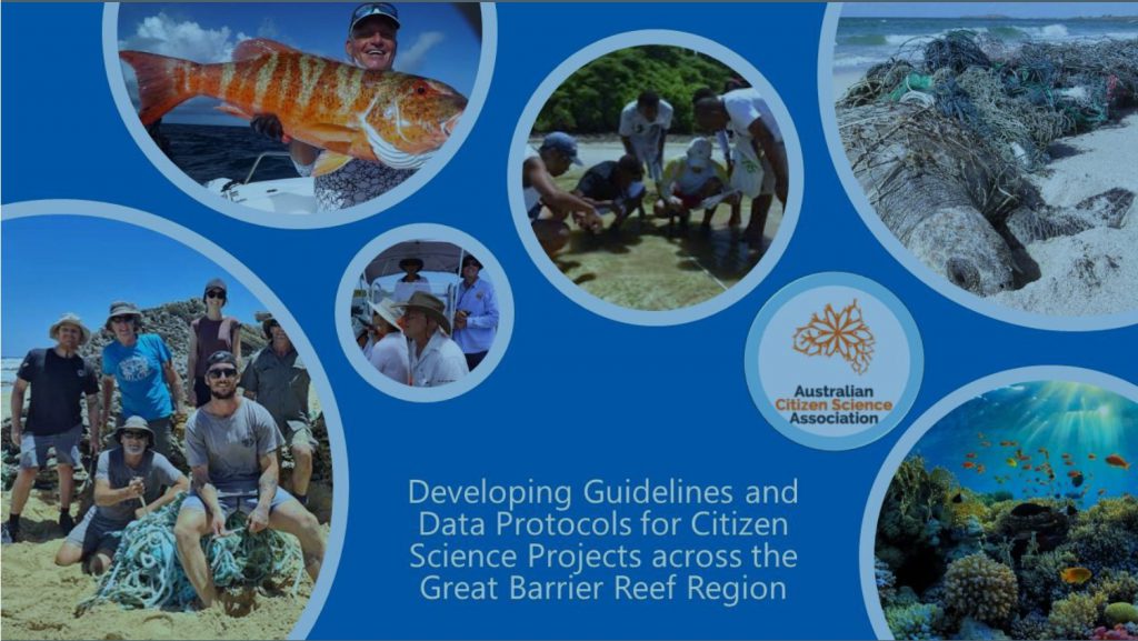
In 2024-25 ACSA Queensland undertook a review of Citizen Science projects across the iconic Great Barrier Reef (GBR) region. The project was funded by the Department of Climate Change, Energy, the Environment and Water through the Australian Government’s Reef Trust.
The review provided insights into what is being monitored and where, along with opportunities that may exist for future Citizen Science in the region. Gathering feedback from Project Leaders, we also learned where the sector needs more support in the future.

With over 40 different activities on offer and over 140 individual groups delivering Citizen Science, the commitment to the GBR is clear. Queensland’s citizen scientists are not only monitoring, educating, and increasing awareness, but the majority are also stewards for Reef species and habitats.
94% of respondents from a survey of GBR citizen science project leaders said that some or all their citizen science participants were also involved in GBR stewardship activities.
The project culminated with the production of three useful tools to support future citizen science on the Great Barrier Reef:
- Guideline to develop future Great Barrier Reef citizen science projects – to support project leaders (including scientists, researchers and community members) with the development of future GBR citizen science projects; increase awareness of the ten core principles of citizen science; and provide new knowledge and understanding that support stewardship and management of the GBR.
- Data standards – to make collected data accessible, standardised, relevant at different scales, and suitable for multiple analyses.
- Scientist and Technical Expert list – key advisors (listed by name and areas of expertise) for citizen science projects.
If you are interested in taking part in a Reef Citizen Science project, check out SciStarter Australia to find a project that may suit you or check out the list of participating projects below.
For more information about the project, please contact project officer, Sue Sargent.
Project list
These Great Barrier Reef projects were included in ACSA Queensland’s review. Click on any of the projects listed below for a brief description and a link to their website.
Amplifying Reef Citizen science (Reef Legacy)
Amplifying Reef Citizen Science (Reef Legacy)
Keywords: Citizen Science
Description:
Project led by Great Barrier Reef Legacy to improve the accuracy, reliability and usefulness of citizen science programs on the Great Barrier Reef. The first pilot program of its kind on the GBR, this project monitors and assess an inshore, midshelf and offshore reef off of Port Douglas with the ultimate goal of demonstrating how multiple citizen science datasets can be collated and reported using a centralised platform. It conducts and combines a multitude of existing reef citizen science programs including QUT’s Virtual Reef Diver in order to provide end users with easy access to a wide range of health indicators which can ideally be utilised to improve model estimates of Reef health.
Atlas of Living Australia

Keywords: Biodiversity
Description:
The Atlas of Living Australia (ALA) is a collaborative, digital, open infrastructure that pulls together Australian biodiversity data from multiple sources, making it accessible and reusable. The ALA helps to create a more detailed picture of Australia’s biodiversity for scientists, policy makers, environmental planners and land managers, industry and the general public, and enables them to work more efficiently. The ALA is the Australian node and a full voting member of GBIF – the Global Biodiversity Information Facility – an international network and data infrastructure funded by the world’s governments and aimed at providing anyone, anywhere, open access to data about all types of life on Earth.
Australian Marine Debris Initiative
Australian Marine Debris Initiative
Keywords: Debris
Description:
Coordinated by Tangaroa Blue, the AMDI is delivered by a network of communities, schools, industries, government agencies and individuals focused on reducing the amount of marine debris washing into our oceans. Volunteers participate in a range of activities including:
- Marine debris clean-ups (and data collection): Removing rubbish from the environment restores the natural state and mitigates the toxic effects of plastics degrading in the environment.
- Source reduction: preventing rubbish from ending up in the environment in the first place.
- Waste reduction: Waste that does not exist cannot become a problem. Working with different stakeholders to promote and implement best-practice sustainable solutions and true circular economy mode.
Australian Microplastic Assessment Project (AUSMAP)
Australian Microplastic Assessment Project (AUSMAP)
Keywords: Debris
Description:
Citizen scientists collect, sort, and identify microplastics in their local area. By creating vivid maps of microplastic pollution hotspots around Australia, this work will enable communities and government to implement behaviour change, regulate industry, and develop better waste management systems. Solutions come fast when you can actually see the problem!
Beach-nesting Birds

Keywords: Birds
Description:
The Beach-nesting Birds Pilot Study project engaged citizen scientists to monitor the distribution of beach-nesting birds in southern Queensland, conduct assessments of local threats to breeding beach-nesting birds and determine the feasibility of management actions and the establishment of a long-term monitoring program. Currently there is no wide scale understanding of the impact of recreational beach use in southern Queensland, and it is unclear where management and threat mitigation action would be the most productive to markedly improve breeding success for populations of these species. The Pilot project was funded by a 2020 QGCS Grant.
Citizens of the Great Barrier Reef
Citizens of the Great Barrier Reef
Keywords: Great Barrier Reef (multiple)
Description:
Conduct a range of programs:
- The Great Reef Census – a groundbreaking citizen science initiative to survey the far reaches of the Great Barrier Reef, virtually bringing together the local reef community with people across the world.
- The Reef Cooperative – A collective of some of the reef’s brightest minds working on a holistic reef restoration/conservation project on selected sites on the Great Barrier Reef.
- Reef Tracks – Real-time data on some of your most-loved reef residents, showing their movements and location since they were first tagged by researchers. This data will help unlock some of the mysteries of the Great Barrier Reef!
Cloud Observations
Keywords: Atmosphere
Description:
Clouds are a major component of the Earth’s system that reflect, absorb, and scatter sunlight and infrared emissions from Earth. This affects how energy passes through the atmosphere. The clouds tool guides you through the observation process. Participants provide their location, reporting on overall cloud cover and surface conditions that can impact satellite observations. Optional data include cloud types, cloud opacity, sky conditions and visibility, then taking photos of what you see in the sky. Using the Cloud Observer app, participants can check the timing of satellite flyovers for your location, and set notifications to remind them to make an observation. Currently over 350 schools and other organisations registered in Australia.
CoralWatch

Keywords: Coral
Description:
CoralWatch integrates global coral health monitoring with education and public outreach creating reef awareness using simple and engaging tools. This provides people with accessible information about coral reefs and climate change, and hands-on experience collecting scientific data on coral bleaching using the Coral Health Chart. The chart is an easy-to-use tool to quantify changes in coral colour associated with coral bleaching on the reef.
EarthWatch

Keywords: Coral
Description:
Earthwatch connects people with scientists worldwide to conduct expeditions/environmental research and empowers them with the knowledge they need to conserve the planet. Coral reefs face a growing number of threats, from climate change and storm damage to sediment and nutrient run-off. Join us in the waters of the Great Barrier Reef to help scientists develop best-practice methods for coral recovery. Participants make a financial contribution to defray costs.
Eye on the Reef
Keywords: Great Barrier Reef
Description:
The Eye on the Reef monitoring and assessment program enables anyone who visits the Great Barrier Reef to contribute to its long-term protection by collecting valuable information about reef health, marine animals and incidents that is used to understand the bigger picture and inform how the Reef is managed. There are a number of ways to get involved, and everyone’s contribution is welcomed — whether you’re a regular day tripper, tourist on their first visit, fisher, Marine Park ranger, marine tourism staff or marine scientist. From downloading the Eye on the Reef app to record reef health, animal sightings or incidents to monitoring programs for people who visit the Reef more regularly, have more time or marine biology knowledge, or are willing to be part of the training.
Eye on the Reef Photo Point Project

Eye on the Reef Photo Point Project
Keywords: Coral
Description:
A coral reef monitoring project using geo-reference underwater photograph and artificial intelligence to bridge the gap between tourism citizen science staff and dedicated marine science. Since the pilot project ended, the project has been adopted by GBRMPA and integrated into the everyday surveying that tourism operators have been doing since 1986. Marine Discoveries has been a key part of the integration and currently runs the Photo Point survey for many of the Cairns and Port Douglas tourism industry vessels. The inclusion of the additional survey has created an enduring change in the industry that will lead to increased knowledge of sites, a regenerative visitor experience and stronger management.
Ghost Nets Australia
Keywords: Debris
Description:
GhostNets Australia has already facilitated the rescue of over 300 entrapped turtles and removal of 13,000 nets from our beaches and estuaries. But there are lots of unanswered questions including: Why do some regions receive more nets than others? How long does a ghost net stay in the water before it is beached? Is this rubbish Australian? If not, where does it come from? And who is responsible? How does a ghost net move? How many animals are entrapped by a ghost net? and What to do with all this rubbish? To answer these questions GNA, in partnership with CSIRO, has been able to learn from the nets themselves many things, use computer modelling to map their fishing effort and track nets in situ using satellite tracking technology.
GIRT Scientific Diver

Keywords: Ship Wrecks
Description:
Gathering Information via Recreational and Technical (GIRT) Scientific Divers is a conservation focused no-impact citizen-science project. It aims to train members to systematically document observable physical and natural features of historic shipwrecks, submerged aircraft and other underwater cultural heritage in an open sea water environment, to facilitate their ongoing protection and management. The focus of the GIRT citizen science project is to enable better understanding of the condition of sites and the factors driving their preservation or deterioration. It also aims to encourage interested people to have an active and positive public archaeology role.
Great Barrier Reef Dolphin Project
Great Barrier Reef Dolphin Project
Keywords: Dolphins
Description:
Funded through the Integrated Monitoring and Reporting component of the partnership between the Australian Government’s Reef Trust and the Great Barrier Reef Foundation. Through this project, the team will be using a suite of multidisciplinary survey methods to capture a snapshot of the abundance and distribution of inshore dolphins along the northern Great Barrier Reef. The study area between Port Douglas and Cape York is regarded as some of the most pristine and unexplored sections of the Reef. The methods include carrying out visual surveys on boats, using citizen science to collect data, as well as spatial modelling.
Great Southern Bioblitz
Keywords: Biodiversity
Description:
The purpose of this event was to highlight both the immense biodiversity spread across the Southern Hemisphere in the spring (November), as well as to engage the public in science and nature learning. The ‘Great Southern BioBlitz’, or ‘GSB’ for short; conducted over four days of intense biological surveying (with photographs and sound recordings) in an attempt to record all the living species within several designated areas across the Southern Hemisphere in Spring. Although an annual event – this isn’t specific to the GBR/marine, but may generate ad hoc reports or could be used to help survey a specific area.
Grey Nurse Shark Watch
Keywords: Sharks, Grey Nurse Sharks
Description:
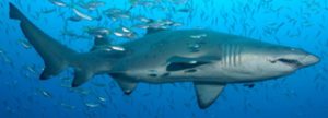
Monitor the population of the Critically Endangered Australian east coast population of Grey Nurse sharks. GNSW provides information on the distribution and movements at different stages in their life history, provide data to enable interactions with commercial and recreational fishing gear to be quantified, along with associated injuries and any shark recovery, help identify new aggregation sites, increase public awareness, and provide data for management purposes via an open and transparent mechanism that involves interested parties. Note: current known aggregation sites are all located south of the GBR (northernmost known is Wolf Rock, SEQ).
Humpback Whale Research
Keywords: Whales, Humpback Whales
Description:
Initial work involved photo-identification of humpback whale flukes (or tails), and song recordings. PWF have also studied humpback whale movement and connectivity. Whale & Dolphin Tracker app is the latest iteration of a long-term citizen-science program for monitoring and collecting data on marine wildlife. With this free app available citizen scientists can now log humpback whale sightings in real time and upload photos from your mobile device. Also conduct Swim-with-whales Impact Study, Assessing Swim-with-whales Tourism. Participants make a financial contribution to defray costs.
iNaturalist
Keywords: Biodiversity
Description:
iNaturalist is an online social network of people sharing biodiversity information to help each other learn about nature. It’s a crowdsourced species identification system and an organism occurrence recording tool to record observations, get help with identifications, collaborate with others to collect this kind of information for a common purpose (it can host a specific project – like a BioBlitz), or access the observational data collected by iNaturalist users.
Keen Angler Program
Keywords: Fish
Description:
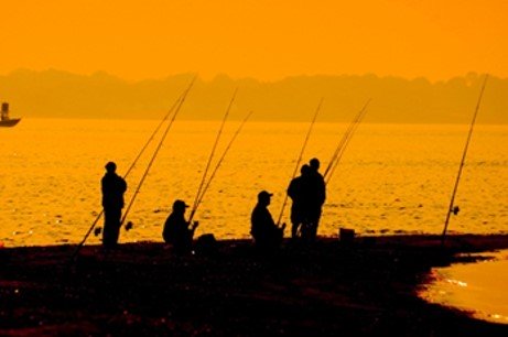
The main aim of the Keen Angler Program is to source fish samples (frames) from recreational fishers. The biological information collected from these samples (including fish frames and otoliths) and other information collected from recreational and commercial fishers is used to assess the health of fish stocks. These assessments help evaluate the effectiveness of fisheries management arrangements.
Leeper Reef – Diversity and Resilience Study

Leeper Reef – Diversity and Resilience Study
Keywords: Reef
Description:
This citizen science project focused on the coral species located on Leeper Reef, near Sarina Beach on the Queensland Central Coast. Although part of the Great Barrier Reef, Leeper Reef and similar locations are often overlooked in terms of coral species in favour of the more popular tourist destinations. This project provides an opportunity for citizens, local government, industry and environment organisations alike to gain awareness of the coral life inhabiting this area of our coastline, and the elements impacting the reef.
MangroveWatch
MangroveWatch
Keywords: Mangroves
Description:
MangroveWatch is a not-for-profit organisation that focuses on the research, education and conservation of mangrove and tidal wetland environments globally. The Queensland chapter has a number of Indigenous Land and Sea Ranger Teams trained including the Northern Torres Strait (Torres Strait Regional Authority Rangers), Eastern Princess Charlotte Bay Rangers, Southeastern Gulf of Carpentaria (Normanton and Burketown Rangers hosted by Carpentaria Land Council Aboriginal Corporation), Port Curtis and the Southern GBR Coast (Gidarjil Rangers), and with community partners at Cairns and Far North Environment Centre (CAFNEC), Moreton Bay and Islands, and Logan. MangroveWatch is currently being delivered by EarthWatch Australia.
Minke Whale Project
Minke Whale Project
Keywords: Whales, Minke Whales
Description:
The Minke Whale Project (based at James Cook University in North Queensland) conducts multi-disciplinary research into dwarf minke whale biology and behaviour, the social and economic values of the whales and the sustainable management of swim-with-whales tourism. The Minke Whale Project research team works collaboratively with the Great Barrier Reef swim-with-minke whales tourism industry, Reef managers and wildlife conservation non-government organisations. Citizen scientists can submit a sightings sheet or make an online report of Dwarf Minke Whales from anywhere in the world.
Ozfish Unlimited
Keywords: Fish Habitat Restoration
Description:
Australia’s only fishing conservation charity – dedicated to empowering and supporting recreational anglers and their communities to take control of the health of their rivers, lakes and estuaries. Operate across the country through a network of members and volunteers, organised into local Chapters. OzFish has delivered dozens of impactful habitat restoration projects that benefit fish. By restoring habitat, they improve Australia’s waterways and provide healthy environments for native fish species to not only survive but thrive supporting future fishers.
Project Manta
Keywords: Manta Rays
Description:
Manta rays are somewhat of a scientific mystery. Very little is known about these gentle giants which reduces the ability to protect them. Sadly, the Reef Manta Ray is listed as Vulnerable to Extinction on the IUCN Red List of Threatened Species. This is due largely to targeted fisheries in parts of their global range, combined with their conservative life history traits.Project Manta is a highly successful research project that is engaging the general public, scientists and industry in the conservation of manta rays.
Queensland Turtle Conservation Project
Queensland Turtle Conservation Project
Keywords: Marine Turtles
Description:
QTCP groups are located throughout Queensland. Project involves research and monitoring of marine turtles. Training will be provided. Open to anyone over 18 years of age with excellent health and fitness. This is a program of scientific research which requires you to walk multiple kilometres in soft sand every night, in the dark, and in all weather conditions. Please consider whether your health and fitness will allow this before applying. Participation is dependent on undertaking training at Mon Repos (or Sunshine Coast).
RedMap

Keywords: Climate Change, Marine Species
Description:
RedMap (Range Extension Database & Mapping project) invites the Australian community to spot, log and map marine species that are uncommon in Australia, or along particular parts of our coast. Australian fishers, boaters, divers and scientists – from Hobart to Broome to Townsville to Sydney to Melbourne— are be able to log onto redmap.org.au and report any uncommon fish and marine life they don’t usually see along their stretch of coastline. Data will help highlight marine range shifts around Australia as the marine environment changes, including warming seas, so that management and research can be directed into hotspots or particular species along Australia’s coastline.
Reef Blitz

Keywords: Great Barrier Reef
Description:
Reef Ecologic have initiated and supported a number of citizen science projects throughout Australia and internationally. They deliver capacity building and upskilling to fulfil long-term monitoring needs and collaborate with existing citizen science organisations utilising complementary reef monitoring projects (e.g., Eye on the Reef, Reef Check Australia, Coral Watch) to expand knowledge and share information regarding the health of the reef in the Townsville region including Magnetic and Palm Islands. In 2023, through Reef Blitz undertook Fish of Queensland, Sharks and Rays of Queensland and Koinmerburra Ridge to Reef Citizen Science iNaturalist projects.
Reef Check Australia (RCA)
Keywords: Reef
Description:
Reef Check monitors more than 40 sites located in 4 main regions of the coast of Queensland – Cairns/Port Douglas, Townsville, the Whitsunday Islands and the Southern Great Barrier Reef (Heron Island). Citizen science, community engagement and locally based actions to support reef resilience are all identified as important strategies for managing the Great Barrier Reef.
Reef Life Surveys

Keywords: Reef
Description:
Reef Life Survey is a citizen science program in which trained SCUBA divers undertake standardised underwater visual surveys of reef biodiversity on rocky and coral reefs around the world to monitor biodiversity status and trend. Survey methods involve divers recording fish and invertebrate species seen along underwater transects using underwater pencils & paper. Although not high-tech, when undertaken by experienced surveyors, these methods allow coverage of species not able to be recorded by other methods, and are both cost- and time-effective. Photographs are also taken of the coral or seaweed cover on each survey. The complete methods cover the majority of plans and animals greater than 2.5cm in length that make up the life of rocky and coral reefs. Last major survey 2020 lap of Australia.
Saving Nemo (IC-Anemone)
Saving Nemo (IC-Anemone)
Keywords: Fish, Clownfish
Description:
IC-ANEMONE is the first global database aimed specifically at better understanding where and when clownfish and anemones are occurring and what threatens their survival in the wild. IC-ANEMONE is a website app developed in collaboration with iNaturalist- to provide an online social network of people sharing biodiversity information. Users can upload information directly using our IC-ANEMONE android phone app or through the iNaturalist website. Users can then explore and compare other clownfish and anemone sightings on the dedicated website.
Sea Flowers: growing community engagement for seagrass restoration
Sea Flowers: growing community engagement for seagrass restoration
Keywords: Seagrass
Description:
Engaging community members in protecting the health of their coastal waterways by participating in the collection of seagrass flowers and seeds for use in habitat restoration programs. The seagrass flowers will be used in seed storage, germination, viability and restoration by seed studies while educating and promoting the value of these habitats to the local community.
Seagrass-Watch
Keywords: Seagrass
Description:
Seagrass-Watch Global Seagrass Observing Network (established in 1998) is a not-for-profit organisation that accurately monitors the status and trends in seagrass condition. The network has conducted over 5914 assessments at 418 sites across 26 countries, involving thousands of dedicated participants. Seagrass-Watch is one of the largest long-term seagrass observing programs globally and is highly recognised for its scientific rigour. Seagrass-Watch participants are from a wide variety of backgrounds. All share a common interest in marine conservation. Most participants are associated with universities & research institutions, government (local & state) or non-government organisations.
Searching for the Yellow-bellied Sea Snake
Searching for the Yellow-bellied Sea Snake
Keywords: Sea Snakes, Yellow-bellied Sea Snake
Description:
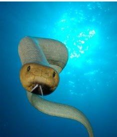
The project seeks to improve current understanding of species composition and abundance in Australian waters. Recent DNA sequencing of sea snakes in the Gulf of Carpentaria revealed two new species with many more cryptic species waiting to be discovered, but lack tissue samples from many parts of Australia. A secondary goal is to promote understanding and respect for sea snakes. Although snakes are frequently encountered (e.g. by tourists snorkelling on the Great Barrier Reef or workers on prawn trawlers), many people hold misconceptions on whether these snakes can bite (they can!) or whether they are venomous (they are!). By extending public outreach the project hopes to dispel myths, while also encouraging a curiosity of, these remarkable marine reptiles.
See Cucumbers: Help save the sea cucumber
See Cucumbers: Help save the sea cucumber
Keywords: Sea Cucumbers
Description:
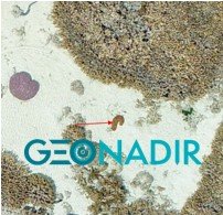
Next time you’re heading to the coast, take you drone and map an area. Use your drone camera to make maps of the environment, following the step-by-step process on the website. Each photo is ‘geo-tagged’ with a location so where know where it was taken. Software is then used to stitch together overlapping photos into a map. Because sea cucumbers are often quite obvious in their environment, they really stand out in low altitude drone images captured at low tide. GeoNadir have trained a computer to recognise them.
Shark’d – A Citizen Science Approach to Understanding Shark Depredation
Shark’d – A Citizen Science Approach to Understanding Shark Depredation
Keywords: Sharks
Description:
Shark’d is a citizen science project developed to help fishers avoid depredation while out fishing. The project provides feedback collected via an App. to the fishing community in real-time in the form of a heat map showing depredation hotspots. The App also provides a way for fishers to share photos documenting depredation. The data serves the recreational fishing community first.
Sharks and Rays Australia (SARA)
Sharks and Rays Australia (SARA)
Keywords: Sharks, Rays, Sawfish
Description:
In 2015, Sharks And Rays Australia started an assessment of the current distributions and abundance patterns of four species of sawfishes in Far North Queensland and the Cape York Peninsula. This study is ongoing, and regions are continually expanded into different regions in collaboration with Indigenous Land and Sea Ranger groups.
Shark Book – Wildbook for Sharks
Shark Book – Wildbook for Sharks
Keywords: Sharks, Whale Sharks
Description:
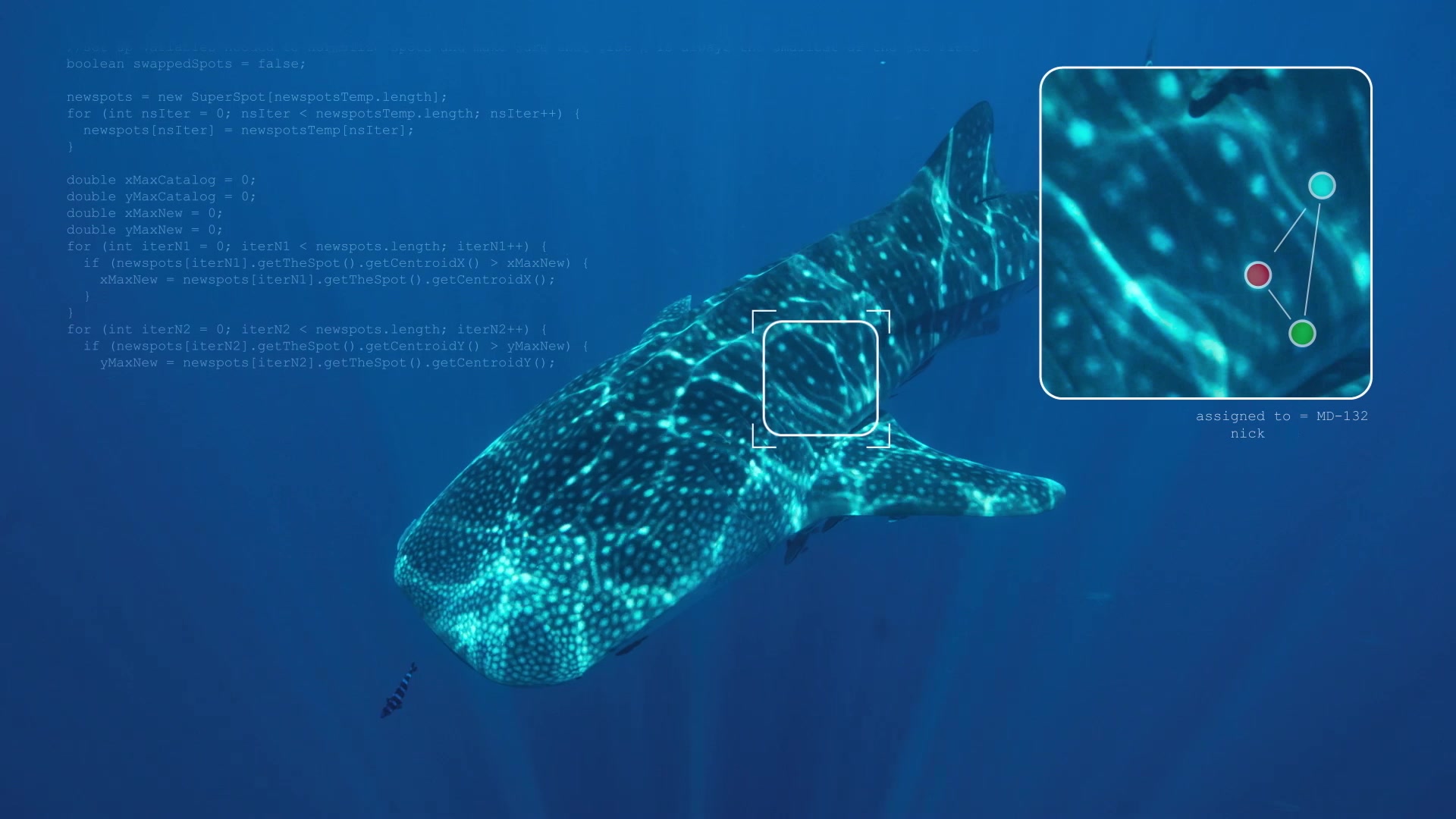
Wildbook for Sharks photo-identification library is a visual database of various shark encounters and of individually catalogued sharks. The library is maintained and used by marine biologists to collect and analyse shark sighting data to learn more about these amazing creatures. The Wildbook uses photographs of the skin patterning behind the gills of each shark, and any scars, to distinguish between individual animals. Cutting-edge software supports rapid identification using pattern recognition and photo management tools. You too can assist with shark research, by submitting photos and sighting data. Information is used in mark-recapture studies to help with the global conservation of these threatened species.
SunTag

Keywords: Fish
Description:
SunTag is a world leading recreational fish tagging and fisheries citizen science monitoring program. Tag and releasing fish, gathering data on tag number, species, length, location, date. Additional information recorded includes the duration of trip, no. of anglers participating and fish tagged/kept or released, along with fishing gear used, GPS location (not disclosed), along with barotrauma, injuries to fish etc. and chemical markers.
The Great Reef Census
Keywords: Reef
Description:
Uses an innovative approach to assessing reef health and piloting new ways of capturing large-scale reconnaissance data from across the Great Barrier Reef. The information will then be used by the marine science community, marine managers, conservation and industry groups to help understand the constantly changing and evolving condition of the Great Barrier Reef. Whether you’re on the Reef or on the other side of the world, you can be a part of this important conservation initiative by submitting or helping to analyse a survey.
TrackMyFish
Keywords: Fish
Description:
InfoFish works with trained recreational fishers using a dedicated App to collect catch data and tag fish in Queensland fresh, estuarine, and marine waters, providing information on: effort and landings, species catch diversity, length frequency, seasonality, and migration. The Women’s Recreational Fishing League (WRFL) have also created a new event called the FISHERQUEST that uses the App.
Using seagrass to monitor the health of marine ecosystems

Using seagrass to monitor the health of marine ecosystems
Keywords: Seagrass
Description:
Monitors the presence, absence, species, and condition of seagrass, to evaluate the health of marine ecosystems. Students are trained to collect data, and teachers to use the data in their teaching, so that students can analyse and communicate the data they have collected. The program aims to engage students with the importance and health of marine ecosystems, and teach them the importance of Data Science as a tool for problem solving and scientific communication. The project also contributes data to ALA.
Virtual Reef Diver (VRD)
Keywords: Reef
Description:
Virtual Reef Diver is a collaboration between scientists, managers, citizens, data analysts, marine explorers and reef operators working together to record, analyse and predict coral cover on the Great Barrier Reef. The aim of the project is to tap into the power of citizen science to dramatically increase the amount of monitoring data within the Great Barrier Reef, and then translate these crowd-sourced data into valuable information that managers can use to make better decisions. Draws on data from AIMS, GBR Legacy, RCA, Underwater Earth, UQ Global Change Institute and UQ Remote Sensing Centre.
Wader Surveys
Keywords: Birds
Description:
Queensland Wader Study Group has undertaken a number of surveys counting waders on high tide roosts along almost the entire Queensland coast. Surveys have been undertaken since the early 1990s. These surveys have been funded by a wide range of agencies, including the Queensland Department of Environment and Resource Management, Burnett-Mary Regional Group, Natural Heritage Trust and WWF Australia. In addition, QWSG members undertake regular monthly counts with a particular focus on the Summer and Winter Count (census) dates. Now have My Shorebird Watcher App.

