By Karen Guymer
Getting to know Wingecarribee Waterways
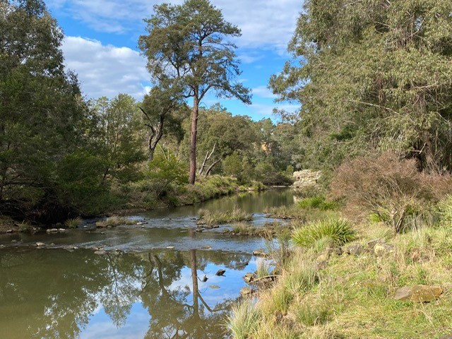
The Wingecarribee Shire, also known as the Southern Highlands, features meandering rivers, tranquil creeks and majestic waterfalls. This water supports our towns, farmlands, forests and biodiversity.
Council is responsible for many thousands of kilometres of waterways within 3000ha across 38 bushland reserves within Wingecarribee Shire.
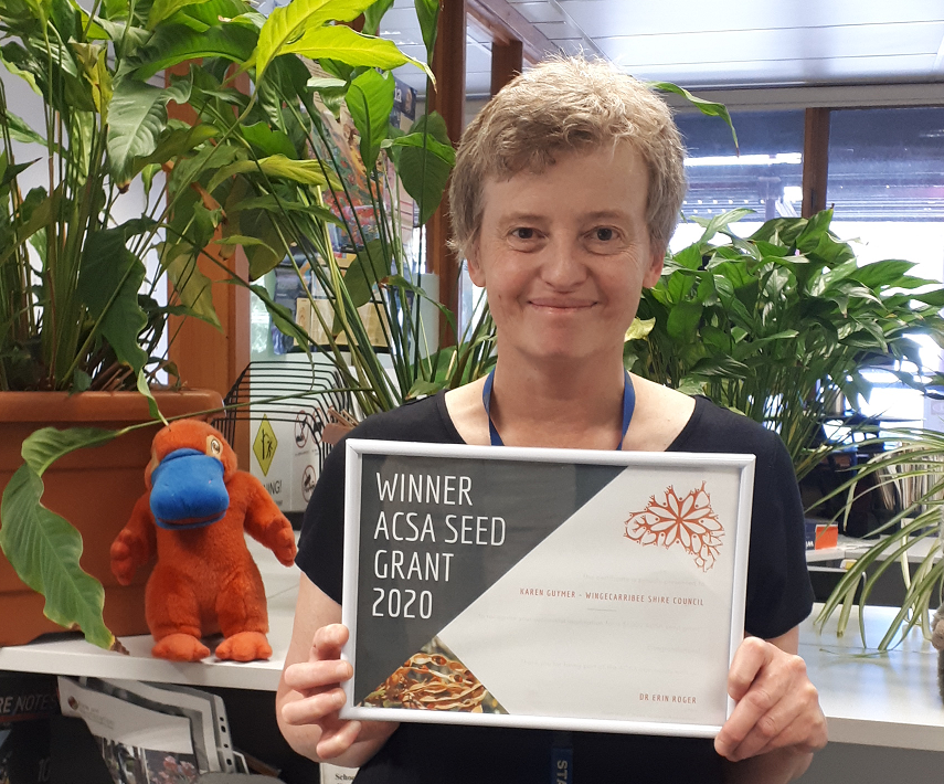
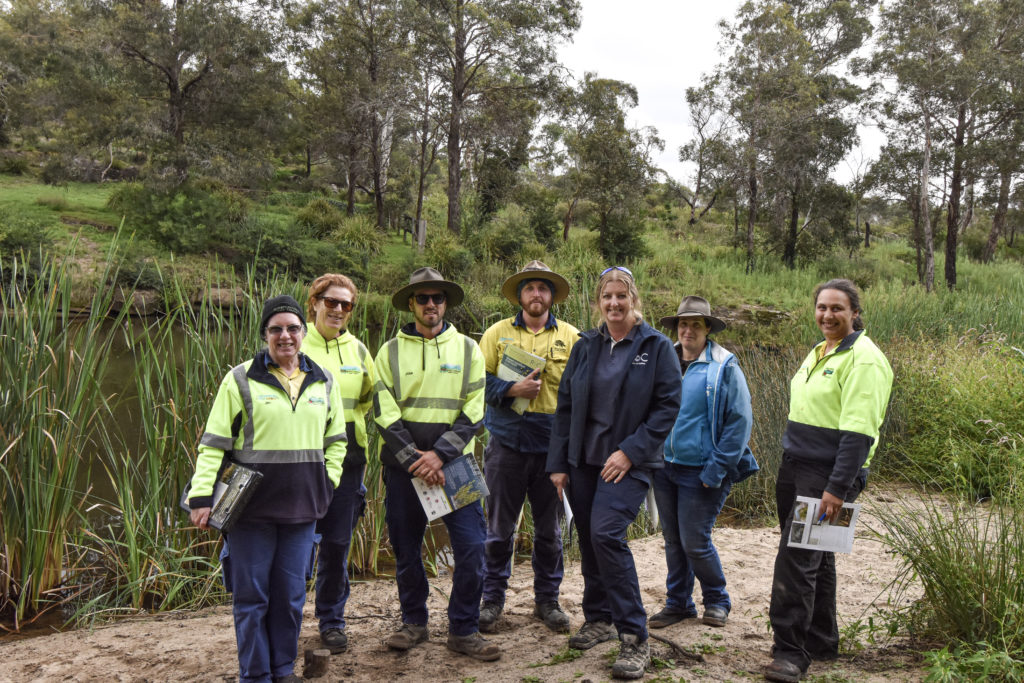
Winning the ACSA Seed Grant in 2020 was fantastic as it enabled us to train council staff in the Bushcare, Natural Resources and Sustainability Services Teams in understanding more about river heath assessments and the tool used to do this, the Rapid Appraisal of Riparian Condition (RARC). The hands-on field day led by Lori Gould, Rivers of Carbon Program Manager with the Australian River Restoration Centre (ARRC), provided theoretical and practical skills and knowledge for staff. As a result of this training,Council is now well-equipped to measure and monitor waterway health to guide ongoing management decisions and to transfer this knowledge to citizen scientists interested in Rivercare and iconic species conservation such as Platypus.
Major waterways are influenced by land use and management in the upper catchment as well as the immediate surroundings and riparian zones. For example, the Wingecarribee River at Berrima is influenced by water releases into Sydney’s drinking water supply, and these are outside of Council control.
The Nattai River has an increasing urban footprint in its upper reaches, which influences stormwater flows and pollutants draining from these areas. Other major rivers such as the Upper Nepean River has large tracts of native vegetation and protected areas as well as agriculture and minor residential development in its upper catchment area.
What are the local challenges?
Like in other areas of Australia, sections of our waterways have been historically disturbed through land clearing, uncontrolled stock access, weed infestations and installation of dams and weirs.
Over time this has restricted important biodiversity corridors, led to localised erosion, impacted water quality and the flow of waterways.
But with many of the waterways and riparian zones in Wingecarribee Shire being owned by Crown Land and adjoining private land, it poses several management challenges.
Collaboration is key
There are several active programs within the shire that assist land managers with improving the health of waterways and riparian land. The Rural Landscape Program administered by South East Local Land Services funds erosion treatment work and fencing stock from waterways.
The Greening Australia led ‘Wall to Wollondilly Project’ aims to raise awareness of the importance of the Wingecarribee River and to encourage adjoining landholders to retain native vegetation and to revegetate where there has been historic over-clearing.
Council taking the lead
Council is working hard to secure its reserves which contain significant waterways. It has recently fenced the Welby Weir Reserve on the upper Nattai Creek, is working to remove the threat from a Gorse infestation, has undertaken weed control work along Nattai and Gibbergunyah Creeks within the Greater Mount Alexandra Reserve and has plans to survey and fence two reserves along Wingecarribee River at Burradoo, near Bowral.
Council has also initiated and drives many important waterway projects. These include:
- Engaging volunteers through the Rivercare program, which assists with improving the condition of riparian zones.
- Leading biodiversity surveys and initiating citizen science opportunities. These include platypus surveys and ongoing biodiversity monitoring using Southern Highlands Nature Map.
What about monitoring the health of our rivers and riparian zones?
Proper planning and monitoring are the cornerstones of any successful project. The ACSA Seed Grant has presented a timely opportunity for the professional development and training for Wingecarribee local government staff in the application of RARC.
RARC monitoring uses a range of indicators such as vegetation continuity and width across a riparian zone, the dominance of natives versus exotics, in-stream large woody debris and natural regeneration to provide a simple overall assessment of the health of our waterways.
This system of assessment has been shown to have a strong correlation with other more time-consuming and technical assessments such as AUSRIVAS. In terms of providing a snapshot of river health and condition at a particular time and place, and for monitoring change, it is a well-renowned and widely used system.
While COVID-19 interrupted the extension of this training to citizen scientists in early 2021, Council staff plan to cover some of the information with our dedicated platypus spotters during the biannual platypus survey at Wingecarribee River in October.
By strengthening the skillsets of several staff, river health assessment guides management actions to improve and enhance the habitat value and function of our waterways.
To Get Involved
https://www.wsc.nsw.gov.au/services/environment/bushcare-and-rivercare/rivercare
Seed Grant Information
If you are interested in applying for an ACSA Seed Grant, please click here.
Wow, that’s a great Citizen Science project to monitor waterway health plus get a snapshot in time result. The added bonus of being able to train staff on the monitoring project must be invaluable especially in protecting a riparian zone. I’d love to know how the RARC monitoring can detect the exotics weeds systems & how the woody weed debris is detected, is it a score value taken from the water samples?
Our Landcare Group Springfield Lakes Nature Care Inc have been rehabilitating a section of a riparian zone that also had platypus DNA recorded & a large adolescence male platypus was captured, tagged & released in the creek system as part of a PHd students reseach with Qld Uni & Platypus Watch program was also commenced this year on 3 creek systems in our catchment which also had positive DNA hits. I’d be interested to know how this monitoring system can help our council improve our catchment, of Opossum, Mountain, Sandy & Woogaroo creeks where platypus were sighted, some had 3 platypus in one section where as others had only one sighted. Water health & a healthy supply of macro-invertebrates is essential for the continued liveability of the creeks for playtypus habitation.
We had some severe storm events in our catchment which led to 70mm of rain in 30 minutes which occured 3 times during the summer storm season causing some of the huge Camphor Laurels, which I suspect had been previously stem injected & poisoned, to fall over into the creek. The creek which flows continuously through the dry period does become is usually shallow in places & although it runs continually, it can be a small trickle in some sections, but has large deeper holes along the creek system. I do see evidence of where the barrages of sticks from woody weeds (lantana etc) cause other debris plastic, polystyrene to build up. Whilst not ideal I often look at the water & wonder if anything can survive as the water doesn’t look clean in these deep hollows, even though the water flowing in is clear. Just curious on your results to date to see if I can pressure our council to take a greater interest in our catchment especially since we have platypus currently residing in the creek. thanks
Great project and initiative.
local challenges are really big in numbers and this is worldwide issue currently.
The pillars of any successful project are proper planning and monitoring.
You’re doing fantastic job, and everyone has to wake up in situations like these and contribute individually.